
Lanjarón Town Hall is pushing its excellent hiking routes, as well as horse-riding routes, & cycle ones, along the municipality's many paths, trails and droves.
 For example, it boasts the Acequia del Aceituno-Cecarta route, the El Cerecillo-Mezquerina one, the Sendero Forestal ‘Peñuela, the BTT1 circular de Tello and the BTT2 Enduro Chaparra.
The length of the circular hiking route, Acequia Aceituno-Cecarta, for example, is just under six kilometres. It has a Level Two difficulty ranking, perfect for families in the summer, thanks to the ample shade to be found along the route.
Starting from the Plaza del Ayuntamiento, the route takes you through the Barrio Hondillo, (the old Jewish quarters) and passes through woods of centenary chestnut trees.
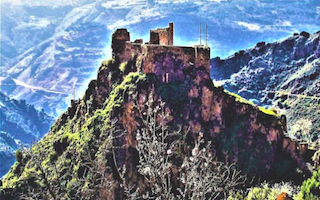
The circular Cerecillo-Mezquerina route covers nearly 14 kilometres and has a Level Three difficulty tag. It goes round the Río Lanjarón valley, ascending along a steep footpath arriving at a height of 1,480 metres above sea level.
it returns on the opposite side of the valley along the Lanjarón-Refugio Ventura footpath as far as the Acequia Mezquerina, and from there down the Camino del Mimbrón, which gives an excellent view of the town. As you can guess, you have to be fit for that one.
Next we come to the Sendero Forestal-Peñuela, almost 10 kilometres long with a similar level of difficulty to the one above.
To find out more about these hiking, horse-riding and mountain bike routes, visit here – as the Town Hall webpage has nothing on it, it appears.
(News: Lanjaron, Alpujarra, Granada, Andalucia)